Winter Mountain Leader course at Glenmore Lodge. February 2023, and assessment February 2024.
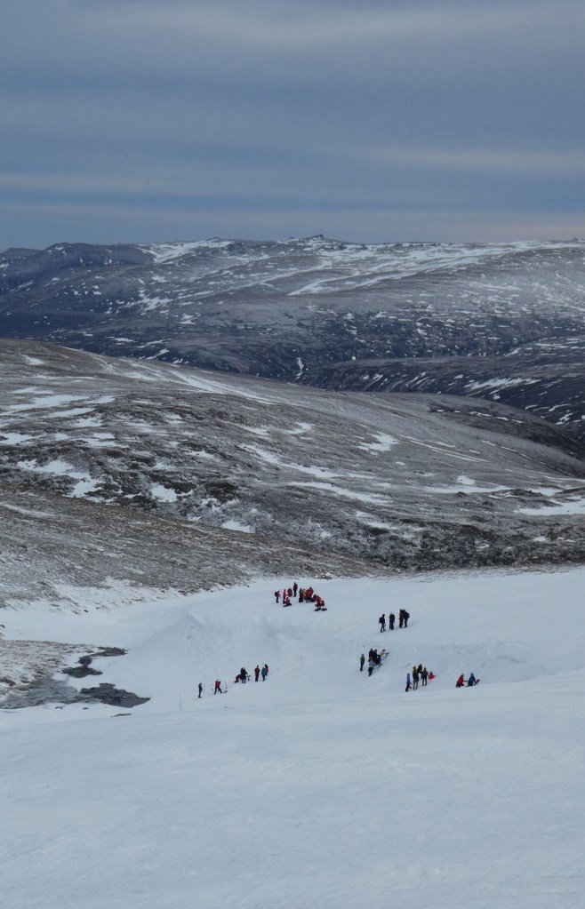
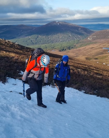
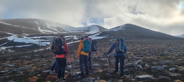
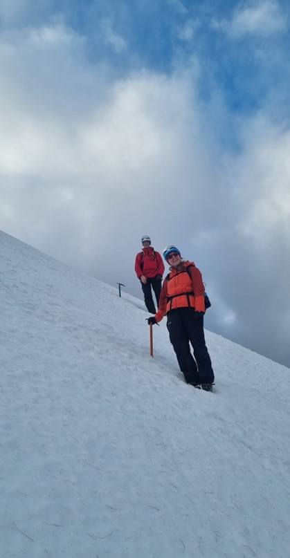
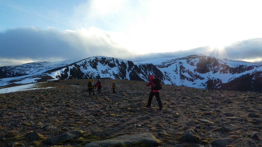
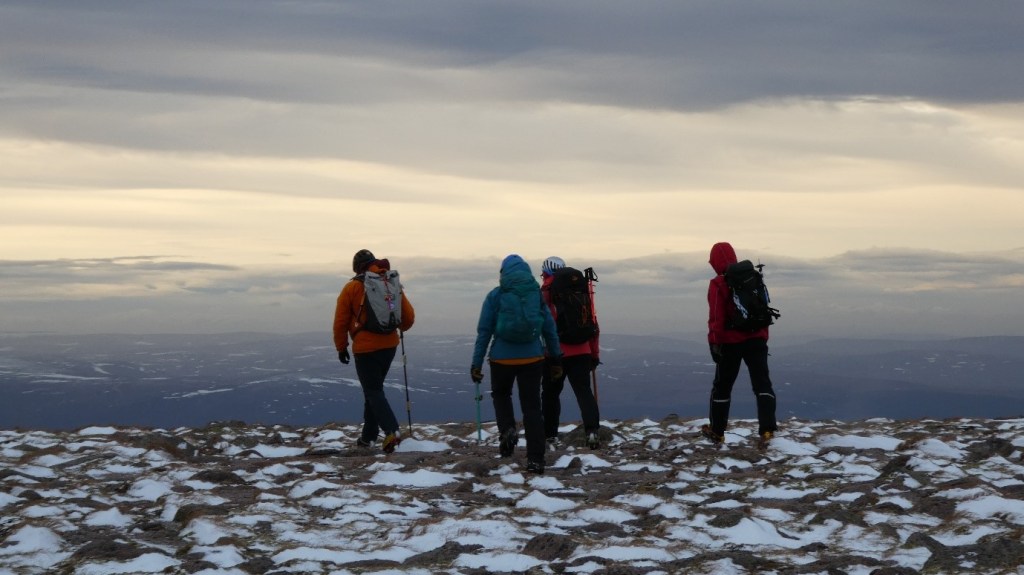
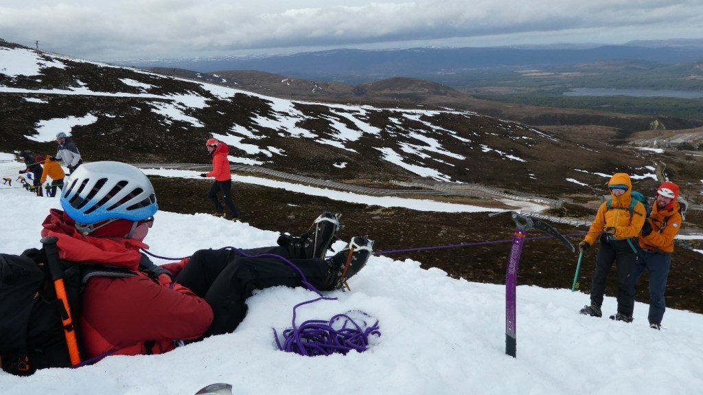
photo credits: P. Amos, AP Mountaineering.
Phil Amos – MLW assessment course report 19th – 23rd February 2024
“We’re here.” I pointed the corner of the compass base plate confidently at Stob Coire an-t Sneachda, a rocky cairn with crags to its immediate north.
A non-committal reply from Sandy – “OK, take us here please.” He pointed to the col south of the 1141 spot height. Easy – a hand rail all the way home.
I walked up and round to the north side of the cairn, and in an instant the world fell metaphorically away from my feet. Instead of looking down crags into Coire an-t Sneachda, the plateau stretched on northwards as far as I could see. We most definitely were not on Stob Coire an-t Sneachda.
Oh you stupid, stupid boy! I had been so confident in where we were being led to that I hadn’t checked the ground truth when we arrived. Whilst the bearings matched up with our direction of travel, my assumption on the end point had been entirely wrong. I quickly re-assessed and pointed a new position to Sandy. Another professionally non-committal reply. I led us off into the gloom, cursing my stupidity.
The full damage was revealed at debrief the following day. I was told everything had gone well the day before, “AND THEN you pointed here….!” Even though I had attempted to correct my mistake, my correction was still wrong and the reason for my mistake was too much. Result – “you’ve lost a life. Don’t do it again!” That had just been a few daytime practice legs, and we still had forty-eight hours of assessment, including night navigation, to go.
Snow and weather conditions in the build up to the assessment had been very poor, with the snow pack being stripped back to almost nothing. Some nervous faces (mine included) that gathered on the Monday morning were anticipating cancellation of the course due to conditions. However there were enough snow patches to assess delivery of the various technical skills, albeit a little bit out of context within a typical mountain journey, and the area east of Ben Macdui was holding enough to provide appropriate conditions for navigation assessment.
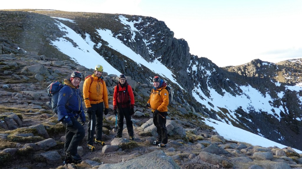
Team mates Phil, Jake and Andrew with Sandy Paterson (Scotch on the Rocks Guiding) on Day 2
Day 1 went smoothly – a journey linking snow patches through Coire Cas, around the flank of Cairngorm and across to Ciste Mhearad. We took it in turn to demonstrate coaching our ‘new clients’ in step kicking, correct use of the ice axe, self belays and step cutting, and then picked a suitable route through consequential terrain to get out of Coire Cas. The remaining snowdrifts in Ciste Mhearad were used to demonstrate personal skills in moving on steep snow.
The first part of Day 2 was spent on a planning exercise, each of us presenting our individual plans for a hypothetical group of clients based on weather and avalanche forecasts, and also describing our personal leadership ethos. It was then up to the Point Five gully area of Coire an-t Sneachda for coaching crampon skills on some snow patches, along with several other parties. We made a quick exit onto the Goat Track col, enjoyed a sunlit stroll across to Coire Domhain and spent the rest of the afternoon digging emergency shelters and demonstrating confidence roping. At 4pm we set off on some navigation legs back home, and right on cue the cloud dropped, the wind picked up and some sharp snow showers set in.

AP Mountaineering
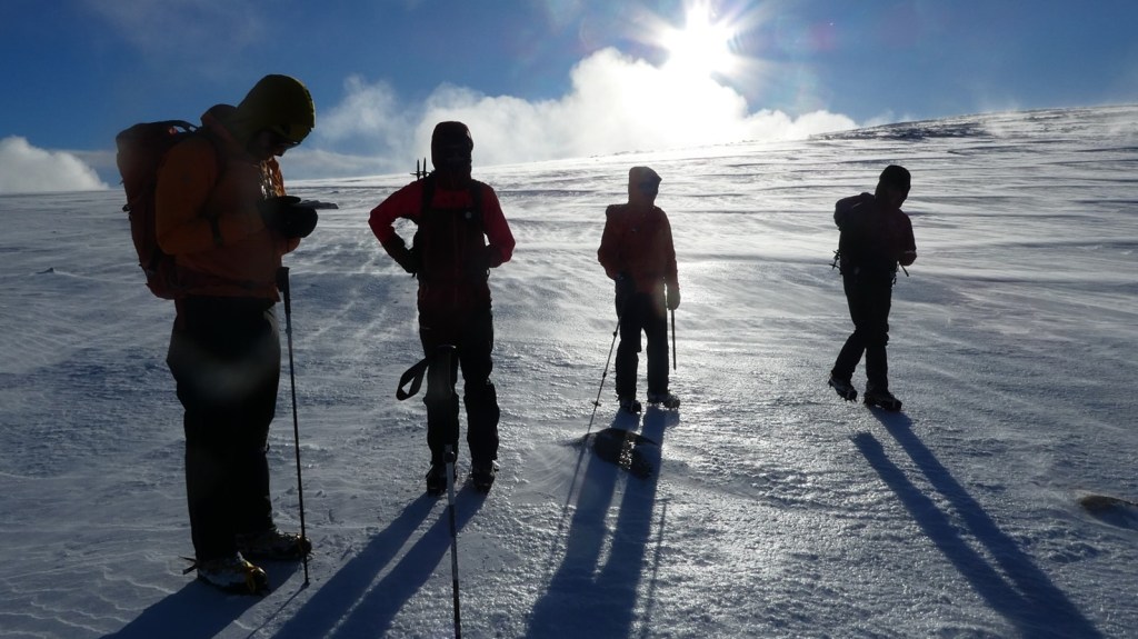
Later on Day 2
The forecast for Day 3 was decidedly sub-optimal – gale force winds and rain. The morning was spent with one-to-one sessions debriefing the previous day and presenting our knowledge on avalanche problems based on a spicey looking avalanche forecast from a few years previously. A very dreich session in the hills near Drumochter followed, building bucket seats, snow bollards and stomper belays on a snow bank sheltered from the wind.
Conditions were not promising for an overnight snowhole expedition, and so day 4 was a 12 hour expedition out to the east side of Ben Macdui. At last the warm and wet weather cycle had broken and the day was stunning, with overnight snow, a fresh to strong wind and temperatures of minus six on the tops. We journeyed out on blind navigation legs, reaching some rocky outcrops at ‘The Zeros’ overlooking Loch Etchachan as the sun began to set. A quick one to one session assessing our understanding of the snow pack and then we hunkered down behind the boulders to cook dinner. My jetboil struggled to light in the cold, but once it was going reheated chilli in a foil bag never tasted so good! My feet were cold, the wind chill was harsh and I was already wearing all of my best winter layers. The sunset over Beinn Mheadhoin was beautiful, but all of us were keen to get moving and get warm again.
Night fell as I led the first leg of our return journey, taking us to a plateau overlooking Loch Avon. Hell’s Lum crag loomed on the left, Stag Rocks ahead and Cairn Gorm, seemingly ever present, dominating the skyline. Things got a bit more interesting in the dark – the windchill bit harder but visibility remained pretty good. The next leg went smoothly, but the leg after that turned into a seemingly endless trudge down the Feithe Buidhe, back up, and then back down to where we had first joined it. Another leader change, and another navigational challenge which ended up with a spiral route to the end point. Three more legs brought us into Coire Cas and at last Kev gave the words we had been waiting for – “Maps away lads, follow me, next stop car park.”
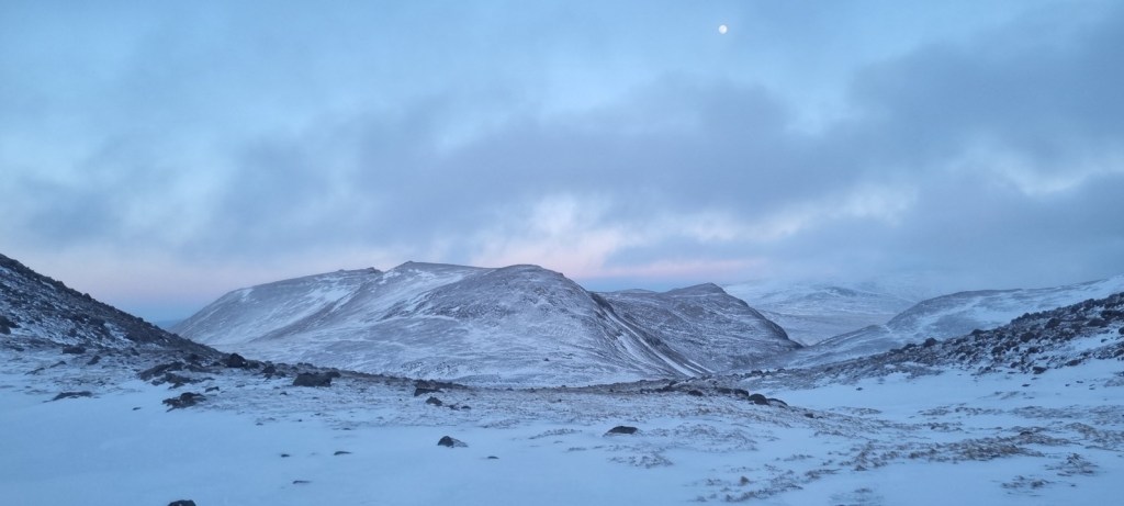
A nav pause on Day 4
Friday, day 5, and everyone gathering at the Hayfield car park was tired. Unlike earlier in the week the chat was subdued – the fifty somethings were popping painkillers, the van lifers were looking forwards to drying out. The activity for the morning started with one to one sessions on how you would organise an avalanche debris search, followed by a practical session in the heather above the Coire Ciste car park. And then finally, finally, an instruction to de-kit, get some food and report back at 3pm for final debrief and results.
So my reflections? Five cracking days in the winter mountains with wonderful people – some I knew already from training, some I got to know during the week and some I had little contact with at the time, but am sure our paths will cross in a wind swept, snow drifted mountainside somewhere.
I’d read a few reports of Winter ML assessments which summarised as “If you’re not nav-ing, you’re digging, and if you’re not digging you’re nav-ing”. To me, that totally misses the whole purpose of the award – it is a qualification to lead people safely in winter mountains, and technical brilliance at digging holes or navigating to the most random of features is no use if you cannot first look after the people you have responsibility for. So your technical skills must be very good second nature, ticking away in the background so you have the capacity to look after your clients.
AP Mountaineering
Beinn Mheadhoin sunset, Day 4
Top tips? There’s plenty of common sense ones out there – practice, practice, practice, go out on the horrible days, go out with fellow candidates for blind leg navigation and critique each other. But here my thoughts.
Don’t forget your summer ML skills – navigation to tiny features below the snowline, knowledge of the mountain environment, mountain names and their meanings etc.
Know your avalanche awareness inside out. Understand the avalanche problems, the importance of the preceding conditions, snow profiles, how all of that is turned into the risk perception and a suitable plan for the day.
If you are dining ‘al fresco’ on the expedition phase, a ready to eat wet meal needing just a warm up is well worth the extra 150g of weight. Quicker to be ready, could be eaten at less than hot, and the heating water can be used for a brew. Some of the other candidates took full length foam mats for sitting on – I wish I had too, the pimpled zig-zag fold up ones would have been ideal. Also a plastic orange bivvy bag to get legs into when sitting around at dinner – or synthetic insulated full length zip trousers if you are flush, have the space and don’t mind the weight!
My navigation was generally successful, and the key points to success were:
Being able to feel the shape of the land changing as you journeyed – getting steeper, getting more gentle, side slope directions.
Using timings over pacing – an MLT UK timing card on my map case and a big £20 watch on my rucsac strap were ideal, and gave me capacity to concentrate on the other aspects whilst navigating.
Using a landranger map (1:50k) blown up to 1:25k scale was a god send. In future I might see if I can blow up the Harvey 1:40k map to 1:25k scale and put that in the other side of my map case.
At each pause or relocation point, use all the techniques to position yourself. Bearing and distance from your start point give you an approximate location. Check the lie of the land in each cardinal direction – if its cloudy do a 50mwalk out and return in each direction. Get a bearing on the slope aspect and understand the slope gradient. Had I religiously carried out those two techniques on day 2 I would not have made the stupid relocation mistake. And scale off the size of significant features from the map, then check how they relate to what’s around you.
Above all, enjoy it, after all its five days out in the hills with experts. Everyone has low points on assessment, no-one admits it at the time, and everyone makes navigation mistakes.
I would like to extend massive thanks to the Neil Mackenzie Trust for supporting my WML journey, to Sandy and his team at Scotch on the Rocks Guiding for their professionalism, knowledge and experience on the training and assessment courses, to Tony Brown at Forces Manor, Kincraig, for providing a wonderful, warm, comfortable and welcoming base for the week of my assessment and the practice days before it, and finally to team mates Phil, Andrew and Jake for their camaraderie, support and encouragement when the pressure was on, and generally for making the five days so enjoyable.
Oh, and my result? Pass! But I (hopefully) won’t be making THAT navigation mistake again!
